[print_link]
Description:
Intermediate, hilly. Moderate traffic on Niles Canyon.
Light traffic on scenic Calaveras Road.
38 miles with 2,200 feet climbing
Directions to Ride Start:
Fremont – Bike path staging area on Old Canyon Road just East of Mission Blvd.
MapQuest: Intersection of Old Canyon Road & Canyon Oaks.
Route:
-coming soon-
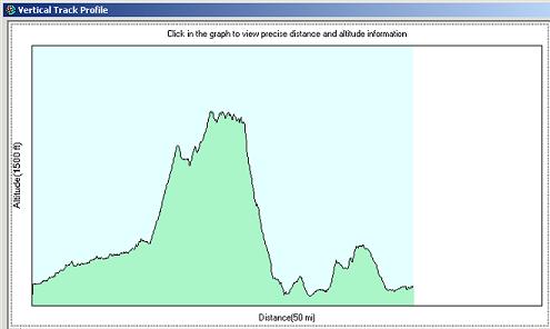
Map and Elevation:
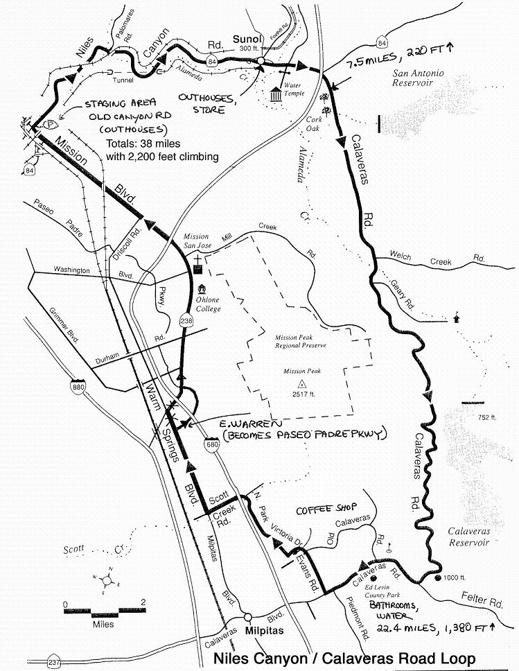
See (and print) full size map of the route by clicking on the above mini-map.
Milage: 38 miles
Climbing: 2,200 ft
Below is the elevation graph.